Toronto City Tour Map: The Complete Guide to Exploring Toronto 2026
Toronto is one of North America’s most exciting cities — but without the right map, you can easily miss its best spots. Whether you’re looking for a free printable Toronto city tour map, a hop-on hop-off route map, or a self-guided walking tour map, this complete guide covers everything. From the CN Tower to the Toronto Islands, we’ve mapped it all out for you.
Where to Find the Best Toronto City Tour Maps
Official Visitor Centres and Information Kiosks
If you want a physical, high-quality Toronto city tour map, the best place to grab one is right at Union Station or the official Destination Toronto visitor centre. These printed guides are honestly a lifesaver because they highlight the major attractions and transit routes in a way that’s much easier to digest than a tiny smartphone screen while you’re standing in the middle of a busy sidewalk.
When you arrive at Union Station, head toward the main lobby where the information booths are located. The staff there are incredibly helpful and will often circle the exact spots you want to see based on your interests. Having a physical paper map of the city is also great for when your phone battery starts to dip after a long day of sightseeing.
Union Station Kiosk: Located in the main Great Hall, open daily for transit and tourism advice.
Destination Toronto: Visit their official website to download digital versions if you prefer keeping everything on your phone.
Hotel Concierge: Most downtown hotels keep stacks of free city maps behind the front desk, so don’t be afraid to ask when you check in.
Pro Tip: Keep your physical map folded in an outside pocket of your bag. It’s way faster to whip out a paper map for a quick reference than unlocking your phone and waiting for GPS to load in the tall concrete canyons downtown.
Interactive Online and Digital Map Resources
For those who prefer a digital experience, there are excellent interactive resources that act as a comprehensive Toronto city tour map. The official City of Toronto website and sites like Authentik Canada provide fantastic web-based maps that show you exactly where the major landmarks are located in relation to the transit grid. These are perfect for planning your route from your hotel room before you head out for the day.
Using a digital city map toronto allows you to click on specific icons to see operating hours, ticket prices, and short descriptions of the venues. You can easily toggle layers to see bike paths, subway lines, or park systems, which helps you visualize the flow of the city better. Most of these digital maps are mobile-responsive, meaning they work perfectly on any smartphone browser without needing to download extra apps.
TTC Trip Planner: Use this to overlay subway and streetcar routes onto your map.
Destination Toronto’s Interactive Map: Use this to find restaurants and museums near your current location.
AllTrails: Excellent for finding walking routes along the waterfront or through the Toronto Islands.
Since you now know where to find the best digital tools, let’s look at what exactly you should be looking for on these maps.
Pro Tip: Bookmark the TTC’s “System Map” on your phone browser. It is the gold standard for understanding how to move around the city via streetcar and subway, which is faster than taking a cab during rush hour.
Table of Contents
What Is a Toronto City Tour Map and Why Do You Need One?
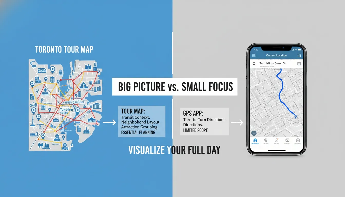
You might be thinking, “Why do I need a paper map when I have Google Maps on my phone?” It’s a fair question, but there is a big difference between a standard navigation app and a dedicated city tour map. While Google Maps is great for finding a specific address, a curated toronto city tour map is designed to help you experience the city. It groups major landmarks, transit hubs, and walking routes all in one view, which helps you understand how different neighborhoods fit together rather than just jumping from point A to point B.
Think of a good tourist map as a cheat sheet for your vacation. It highlights the “must-see” attractions so you don’t accidentally walk right past the CN Tower or the Distillery District without realizing they were just around the corner. Because these maps are designed specifically for visitors, they also include handy things like subway lines and streetcar routes that are actually relevant to your trip. It’s all about seeing the big picture of Toronto so you can plan a smoother, stress-free day.
Types of Toronto City Tour Maps Available
There are several versions of a toronto city tour map, and each serves a slightly different purpose depending on how you plan to travel. The official Visitor Map from the City of Toronto is a classic choice for getting the lay of the land, while specific bus tour maps provided by services like City Sightseeing are perfect if you want to see the main highlights without too much walking. Knowing which one to grab will save you a lot of time.
You might also find that specific, thematic maps are much more useful than a general city overview. For instance, if you are visiting during the colder months, the PATH underground map is an absolute essential for navigating downtown without ever stepping outside into the snow. There are also specialized walking maps for the waterfront and distinct maps for exploring the Toronto Islands, which are otherwise very easy to get lost on if you don’t have a guide.
Official City of Toronto Visitor Map (PDF): The gold standard for a clean overview of downtown, parks, and major cultural hubs.
Hop-On Hop-Off Illustrated Bus Tour Map: Provided by City Sightseeing, this is ideal for seeing major sights like the Royal Ontario Museum and St. Lawrence Market quickly.
Interactive Digital Attractions Map: Best for planning on the go with real-time updates on closures or events.
Toronto PATH Underground Map: Your secret weapon for the downtown core during winter or rainy days.
Self-Guided Walking Tour Maps: Great for local experiences in neighborhoods like Kensington Market or Queen Street West.
Toronto Islands Map: A must-have for navigating the ferry terminals, beaches, and walking paths across the water.
Pro Tip: If you are staying downtown, grab a copy of the PATH underground map early. It is a maze of tunnels that connects office towers and malls, and it’s the best way to avoid traffic while getting from one major attraction to another.
Who Should Use a Toronto City Tour Map?
Honestly, anyone who wants to maximize their time in the city should use a toronto city tour map, but it is especially helpful for first-time visitors. When you are new to a city, it is very easy to feel overwhelmed by the sheer size of the downtown area. A map acts as a visual anchor, keeping you focused on the routes that get you to the best views, museums, and food spots without the constant stress of staring at your phone’s GPS.
Families and senior tourists also tend to benefit greatly from having a clear, printed guide in their hands. It is much easier to gather a group around a map to decide where to go next than it is to squint at a small screen in the bright sunlight. For budget travelers and day-trippers, these maps are equally valuable because they often highlight free walking routes and public transit connections, allowing you to save money on expensive guided tours while still getting the full Toronto experience.
First-time visitors: Keeps you from getting turned around in the busy Financial District.
Families with kids: Makes it easier to spot parks and interactive museums at a glance.
Senior tourists: Provides a reliable, non-digital reference that is easy to read.
Budget travelers: Helps you navigate using transit instead of ride-shares or taxis.
Day-trippers: Perfect for prioritizing the top three or four spots in a short amount of time.
Now that you know who these maps are for and which types are available, let’s explore how you can use them to plan the perfect day of sightseeing.
Pro Tip: If you’re traveling with a group, have one person serve as the “navigator” with the paper map. It makes the day feel more like an adventure and keeps everyone together instead of looking down at individual phones.
Official Toronto Visitor Map: Free Download & How to Get It
The City of Toronto’s official visitor map is the most reliable, free resource available for tourists planning their trip. Unlike random maps you might find on social media or search results, this document is updated annually and verified by local tourism authorities. It cuts through the noise of a bustling city by focusing specifically on the needs of a traveler, ensuring you don’t waste time navigating areas that aren’t relevant to your visit.
Whether you are a first-timer or a frequent visitor, having this specific map acts as your foundational layer for city exploration. It provides a clean, professional view of Toronto’s layout, marking key transit hubs and cultural landmarks so you can navigate with confidence. It is a fantastic starting point for building your daily itinerary, especially if you want to avoid relying solely on data-draining apps.
What Does the Official Toronto Map Include?
The official guide is surprisingly comprehensive for a free resource. It marks over 59 points of interest, ensuring you hit the high notes like the CN Tower and the historic St. Lawrence Market without a headache. Beyond just tourist sites, it overlays essential infrastructure, which is a massive help for anyone who isn’t familiar with Toronto’s specific transit grid.
You will find everything from subway stops to bike-share docking stations clearly marked. Having the hospital locations and major parking lots mapped out also provides a sense of security that digital maps sometimes fail to convey in a simple, at-a-glance format. It is designed to be readable, even for those who aren’t tech-savvy.
59+ places of interest: Major museums, galleries, and historic districts clearly labeled.
Transit Infrastructure: Full details on TTC subway lines, GO Train access, and UP Express routes to the airport.
Getting Around: Streetcar stop locations and Bike Share Toronto docking points.
Safety & Services: Conveniently marked hospital locations and Tourist Information Centres.
Parking: Locations for Green P parking lots, which are generally the most affordable options downtown.
Pro Tip: Keep an eye on the transit markings on your map. If you see a streetcar icon near your location, it is almost always a more scenic and tourist-friendly way to travel across the downtown core than taking the subway underground.
How to Download the Free Toronto Visitor Map PDF
Downloading the map before you leave home is the smartest way to start your trip. You can grab the latest version by visiting the official toronto.ca/visitors portal. They keep an updated version available throughout the year, so you are always looking at current street layouts and attraction details.
The digital PDF is designed with a high level of detail, covering both the dense downtown core and the broader city regions. You can save this to your phone’s files or print a copy to keep in your jacket pocket. Having this version on your phone means you have an offline reference even when you are in areas with poor cellular service or just trying to save your data for other things.
Official Link: Visit toronto.ca/explore-enjoy/visitor-toronto/ to download the latest PDF.
Full Coverage: Includes a detailed zoom-in of the downtown core and a secondary map for the greater city area.
Offline Access: Download it to your phone before you board your flight so you don’t need roaming data to use it.
Pro Tip: If you have access to a printer, print the downtown “detail” section on a single sheet of paper. It’s small enough to fold up into your pocket but large enough that you won’t need to zoom in and out like you do on your phone.
How to Get a Free Paper Map in Toronto
If you prefer the feel of a real map, you are in luck—Toronto makes it incredibly easy to find one once you land. The most iconic spot to pick one up is the Union Station Tourist Information Centre. It is right in the heart of the city’s transit hub, and the staff there are local experts who can point you toward the best current exhibits or festivals happening that week.
If you are staying at a major hotel, don’t even worry about hunting one down; simply ask the front desk. Most downtown hotels stock these maps specifically for their guests. You can also find them at major information kiosks like the ones at the CN Tower or the Eaton Centre. If you want to be extra prepared, you can also send an email to request information in advance.
Union Station Kiosk: The best spot to start your trip, located right in the Great Hall.
Email Requests: Reach out to
visitoreconomy@toronto.cafor specific tourism inquiries or map requests.In-Person Pickup: Stop by any major hotel front desk or the visitor kiosks at the Eaton Centre and CN Tower.
Contact Information: For urgent questions, you can call the city at 416-392-9300.
Pro Tip: Don’t hesitate to ask the staff at the Union Station information desk for their “local favorite” spots. While the map shows you where things are, the staff can tell you which ones are worth your time and which ones are best left for a different day.
Map Scale & Walking Distances You Should Know
Understanding the scale of your Toronto city tour map is key to not over-scheduling your day. The map is designed with a 0 to 5km range in mind, which covers the main “tourist loop.” Most of what you want to see—from the waterfront up to the entertainment district—is a very manageable walk if you break it into chunks.
For example, the walk from the CN Tower to Ripley’s Aquarium is only about 2 minutes, essentially just crossing the street. However, walking from Union Station to the Distillery District will take you about 20 to 30 minutes. Keeping these distances in mind helps you decide when to walk and when to hop on a streetcar.
CN Tower to Ripley’s Aquarium: Approx. 2-minute walk.
Union Station to Distillery District: Approx. 20–30 minute walk (roughly 2km).
Downtown Core to Kensington Market: Approx. 25-minute walk (roughly 2.3km).
General Scale: Most downtown attractions are within a 60-minute walk of each other.
Now that you have your map and understand the layout, let’s talk about using the transit system to save your legs for the fun stuff.
Pro Tip: In Toronto, “walking distance” is often subject to the weather. If it’s a beautiful summer day, the 20-minute walk to the Distillery District is lovely; if it’s mid-winter, take the 504 King streetcar instead!
Toronto Hop-On Hop-Off Tour Map: Routes, Stops & How It Works
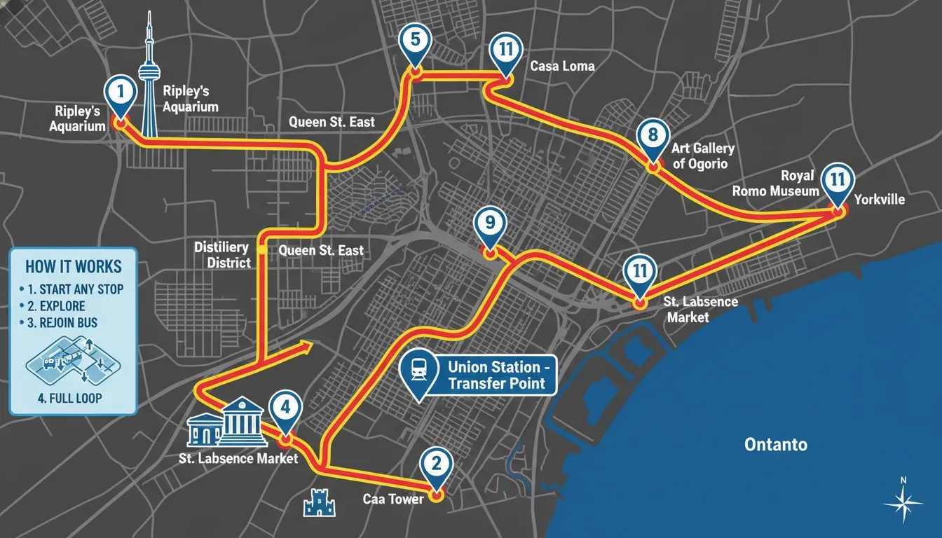
The hop-on hop-off double-decker bus is arguably the most popular tourist experience in Toronto, and for good reason—it’s designed to hit every major landmark without you ever needing to check a subway map. Because this service is so specialized, they provide their own uniquely illustrated toronto city tour map. This map is visually distinct from the standard city guide, highlighting bus routes and specific stops that keep you on track for an entire day of sightseeing.
If you are new to the city, this is often the most stress-free way to explore. You get to see the architecture, the layout of the neighborhoods, and the flow of downtown traffic from the top deck. Having the illustrated map in your lap as you ride helps you identify what you are seeing in real-time, turning a simple bus ride into a personalized narrated adventure.
What Is the Hop-On Hop-Off Toronto Bus Tour?
Operated by City Sightseeing Toronto, this double-decker service is specifically built to cater to visitors who want to see as much as possible in a short time. Their primary hub is centrally located at 1 Dundas St E, right in the heart of the busy shopping district. They also provide a live bus map online, which is a fantastic digital companion if you want to know exactly when the next bus is pulling up to your stop.
The service runs frequently throughout the day, and the drivers are often local guides who share interesting stories about the city as you drive. You aren’t just getting transportation; you are getting a curated tour that hits the highlights of the downtown core and beyond. It is an excellent way to get your bearings on your first morning in the city.
Service Provider: City Sightseeing Toronto (double-decker bus service).
Central Hub Address: 1 Dundas St E, Toronto.
Customer Support: +1.416.410.0536.
Live Tracker: Check their official website for real-time bus locations to avoid unnecessary waiting.
Pro Tip: Try to grab a seat on the top deck toward the back. It’s open-air, offering the best views for photography and avoiding the glass glare that you might get if you’re sitting inside the main cabin.
Key Hop-On Hop-Off Stops on the Map
The bus tour map is structured around the “must-see” spots that almost every visitor puts at the top of their list. From the dizzying heights of the CN Tower to the historic brick-lined streets of the Distillery District, the route is optimized to save you from walking those long distances between major attractions. Even if you don’t stay on the bus for the whole loop, it acts as a great shuttle between your top two or three destinations.
You will find stops right at the doorstep of the city’s biggest cultural icons. The map clearly marks the transition points where you move from the concrete skyline of the Financial District to the historic charm of areas like the Distillery or the cultural depth of Kensington Market. It’s a very visual way to see the different “faces” of Toronto.
Skyline Sights: CN Tower, Rogers Centre, and Ripley’s Aquarium of Canada.
Cultural Icons: Royal Ontario Museum (ROM), Art Gallery of Ontario (AGO), and Casa Loma.
Market & Heritage: St. Lawrence Market, Distillery Historic District, and Kensington Market.
Waterfront: Harbourfront Centre.
Pro Tip: Use the bus to get to Casa Loma, as it’s a bit of a hike from the downtown core. Once you’re there, you can spend hours exploring the castle, and then just hop back on the next bus to head back to the waterfront or the museum district.
How to Download the Hop-On Hop-Off Illustrated Map
Accessing the official illustrated map is incredibly easy and shouldn’t take more than a minute of your time. You can visit [citysightseeingtoronto.com/illustrated-maps] to pull up the latest version for the current season. This map is updated annually to reflect any route changes or new partnership stops, so always make sure you are downloading the most recent version before you head out.
In addition to the standard city tour map, the site also offers downloadable guides for their other excursions. If you are planning a trip to Niagara Falls or thinking about taking a boat tour of the harbour, these maps are worth keeping on your phone as well. They are designed to be user-friendly, clean, and visually pleasing, making them a great souvenir to keep even after your trip ends.
Download Page: Find the illustrated maps at citysightseeingtoronto.com/illustrated-maps/.
Supplementary Guides: Download the Niagara Falls Day Tour map and the Toronto Harbour & Islands Boat Tour map.
Format: These are generally provided in a high-resolution format, making them easy to zoom in on without losing detail.
Pro Tip: Save the PDF directly to your “Files” or “iBooks” app on your phone. This makes it accessible even when you don’t have internet access, which is super useful if you are moving between indoor attractions with thick concrete walls.
Hop-On Hop-Off vs Self-Guided Tour — Which Is Better?
Choosing between a hop-on hop-off bus and a self-guided walk really depends on your travel style and budget. If you are a first-timer who wants to cover as much ground as possible in a single day, the bus tour is objectively better. It removes the stress of transit planning and ensures you don’t miss the major landmarks, effectively serving as an overview of the city.
However, if you are a budget-conscious traveler or you love to move at your own pace, a self-guided approach is the way to go. Walking allows you to pop into those small cafes or hidden vintage shops that the bus just drives right past. The best strategy? Use the bus map to get a high-level overview on day one, and then pick one neighborhood to explore in detail on foot for the rest of your trip.
Hop-On Hop-Off: Best for maximizing time, gaining an overview, and avoiding transit confusion.
Self-Guided: Best for flexible scheduling, deep-dives into specific neighborhoods, and tight budgets.
Pro Strategy: Combine them. Use the bus for the “Big Hits” (CN Tower, ROM) and walk for the “Local Gems” (Queen West, Kensington).
Now that you have a plan for seeing the highlights, you might want to look closer at the map to find the best spots for a quick afternoon snack or a quiet coffee.
Pro Tip: Don’t feel pressured to use the entire bus loop in one go. Hop off at a market, explore for two hours, grab lunch, and then hop back on the next bus. It makes the day feel much less like a commute and more like an experience.
Toronto Neighbourhood Map: Best Areas to Explore
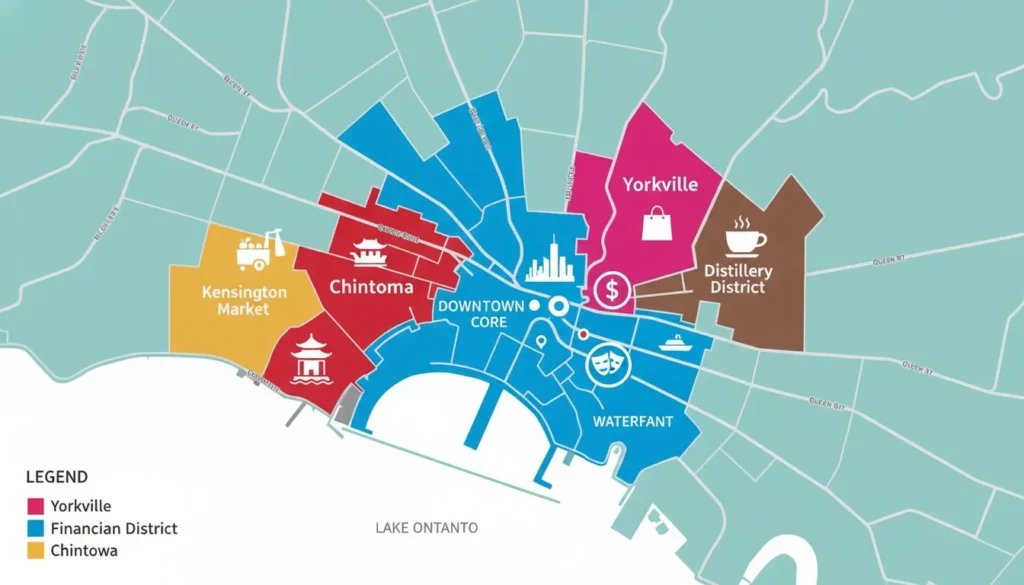
Toronto is a massive collection of unique urban villages, each with its own distinct personality. Looking at a map, it is easy to see that Toronto isn’t just one big city; it’s a mosaic of different cultures and histories. I highly recommend checking out a neighbourhood map before you head out, as it helps you decide which area truly matches your vibe, whether you are looking for high-end fashion, bohemian markets, or historic architecture.
If you try to see everything in one go, you will end up exhausted. Instead, pick a specific neighbourhood based on your interests and dedicate a few hours to just walking around. The real magic of Toronto happens in these local pockets, far away from the main tourist attractions, where you can find the best coffee, the most authentic food, and the most interesting street art.
Downtown Toronto Neighbourhoods on the Map
The downtown core is the heartbeat of the city, and it’s where most people start their journey. On your toronto city tour map, this area is the most densely packed with landmarks, office towers, and transit connections. The Financial District and the South Core are great for seeing the modern skyline, while the Entertainment District is where you’ll find the best nightlife and theaters.
These areas are designed for high energy and fast movement. If you want to be right in the middle of the action—near the big stadiums and the tallest buildings—this is where you should spend your time. It is also the most convenient place to be if you are relying on the TTC subway, as every major line converges in this area.
Financial District: The bustling Bay Street corridor, perfect for seeing the city’s impressive corporate architecture.
Entertainment District: The go-to spot for nightlife, concert venues, and major theaters on King Street West.
South Core: Home to the CN Tower, Scotiabank Arena, and Ripley’s Aquarium; the primary tourist hub.
Downtown Yonge: Anchored by the Eaton Centre and Dundas Square, it is the city’s main retail playground.
Pro Tip: While the downtown core is great, don’t spend your whole trip here. Use it as your base, but make sure to hop on a streetcar to explore the smaller, more historic neighbourhoods nearby.
Cultural & Trendy Neighbourhoods
Toronto’s cultural diversity is its greatest strength, and you can map out a world tour just by hopping between neighbourhoods. From the bohemian, graffiti-covered streets of Kensington Market to the vibrant energy of Koreatown, these areas offer the most authentic look at local life. You will find that each of these spots has its own local “Main Street” filled with independent shops and family-owned restaurants.
If you are a foodie or a lover of unique shopping, this is where you need to be. These neighbourhoods are best explored by walking or cycling, as you really need to be on the street level to notice the murals, the hidden storefronts, and the local festivals that seem to happen every weekend.
Kensington Market: A bohemian and multicultural hub with vintage shops and eclectic food stalls.
Chinatown: Centered at Spadina and Dundas, offering some of the best dumplings in the city.
Little Italy & Little Portugal: Amazing restaurant strips on College Street and Dundas West, respectively.
Koreatown & The Annex: Great for late-night snacks, student-friendly bookstores, and cozy cafes near the university.
Bloor-Yorkville: The place for high-end luxury shopping and sophisticated dining experiences.
Pro Tip: Visit Kensington Market on a Sunday during the summer months when the streets are closed to cars. It becomes a giant pedestrian-only party with music, street food, and pop-up markets.
Historic & Waterfront Neighbourhoods
If you love history or just want to be near the water, the historic and waterfront districts are your best bet. Old Town and the Distillery District are stunning, with their original 19th-century Victorian industrial architecture that has been perfectly preserved. Walking through these areas feels like stepping back in time, and they provide a much-needed break from the modern glass towers of the Financial District.
The waterfront, specifically Queens Quay, offers a different kind of calm. Walking along the lake on a clear day is one of the most underrated experiences in the city. Whether you are exploring the oldest streets in the city in Corktown or checking out the cool, repurposed factory spaces in Liberty Village, these neighbourhoods offer a unique glimpse into Toronto’s past and its modern revitalization.
St. Lawrence & Old Town: Home to over 150 restaurants and the famous St. Lawrence Market.
Distillery Historic District: An incredible pedestrian-only area with original Victorian red-brick industrial buildings.
Harbourfront / Queens Quay: The city’s primary lakeside path, perfect for long walks or boat watching.
Corktown: Known as one of Toronto’s oldest neighbourhoods, full of character and historic charm.
Liberty Village: A cool, trendy area where old factories have been converted into chic cafes and design studios.
Pro Tip: Grab a “peameal bacon sandwich” from the St. Lawrence Market—it’s a true Toronto culinary staple and the perfect fuel before a long walk through the Old Town area.
East & West Toronto Worth Visiting
Don’t limit yourself to the city centre. Some of the best parts of Toronto are tucked away in the east and west ends of the map. If you are craving nature, the High Park area or The Beach offer a massive contrast to the concrete downtown core. You can spend an entire afternoon walking the boardwalk at The Beach or getting lost in the trails and gardens of High Park.
The Danforth and Little India are also fantastic for anyone who loves international cuisine and shopping. These areas are slightly quieter than the downtown core, which makes them perfect for a relaxing day trip. You will get a true sense of how locals spend their weekends, away from the typical tourist crowds.
The Beach: Famous for its long boardwalk and sandy waterfront, feeling more like a resort town than a big city.
High Park: The city’s largest park, featuring its own zoo, hiking trails, and beautiful gardens.
The Danforth (Greektown): A legendary food strip with some of the best Mediterranean cuisine in North America.
Little India: Located on Gerrard Street East, it is a vibrant hub for authentic South Asian food and textiles.
After choosing your favourite spots from this neighbourhood guide, you’ll be ready to map out your own custom adventure through the city.
Pro Tip: Take the streetcar out to The Beach on a sunny day. It’s a scenic ride that takes you through some beautiful residential streets, and the atmosphere on the boardwalk is unmatched during the warm months.
Toronto Self-Guided Walking Tour Map
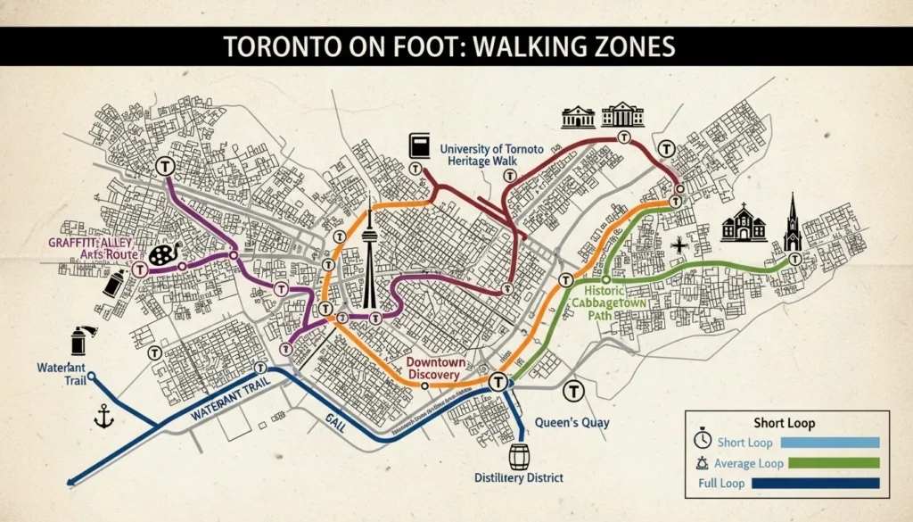
If you want to see the city at your own pace, Toronto offers over 49 free self-guided walking tours officially curated by the City of Toronto. These aren’t just random paths; they are expertly mapped routes designed to show you the hidden character of our neighborhoods. Whether you’re interested in street art, Victorian architecture, or nature trails, these maps allow you to become your own guide while learning the stories that make Toronto special.
Walking is honestly the best way to soak in the local vibe. You catch the small details—the smells of local bakeries, the street musicians, and the unique architecture—that you completely miss when sitting on a bus or taking a subway. With these official routes, you have a clear plan, so you never have to worry about getting lost in an area you don’t know.
Official Self-Guided Tour Types from City of Toronto
The city has broken these tours down into categories, making it easy to pick a walk based on your mood. The “Cultural Hotspot” tours are particularly cool because they take you beyond the typical downtown core and into the vibrant communities where locals actually live and play. These are fantastic if you want to escape the massive tourist crowds and find authentic spots.
You don’t need a professional guide to get a deep history lesson, either. The historical and architectural tours are packed with information about the buildings you’re walking past. They turn a simple walk down the street into a mini-tour of Toronto’s past, from its early industrial roots to its modern, sleek skyline.
Cultural Hotspot Tours: Over 49 diverse routes that explore the neighborhoods outside the busy city center.
Discovery Tours: Nature-focused walks that highlight the green spaces and trails scattered throughout the city.
Architectural Tours: Designed to showcase both our oldest historic landmarks and our boldest modern buildings.
Urban Tours: A curated look at the dense, high-energy downtown core.
Historical Tours: Deep dives into neighborhood legends, local figures, and specific historical events.
Pro Tip: Download a few of these PDFs before your trip. If you find yourself with an extra hour between your main plans, you can quickly pull up a local walk and turn your downtime into an exploration.
Best Free Self-Guided Walking Routes in Toronto
If you are looking for where to start, some routes are crowd favorites for a reason. The downtown discovery tour is a classic, as it hits all the major landmarks while keeping you on pedestrian-friendly streets. For a different vibe, head toward Graffiti Alley near Spadina Avenue; it’s an open-air art gallery that is constantly changing and absolutely perfect for photos.
If you are a nature lover, the Waterfront Trail is arguably the best walk in the city. You get the fresh air off Lake Ontario, clear views of the skyline, and plenty of places to grab a drink along Queens Quay. For those who love historic charm, the Victorian homes walk in Cabbagetown is a quiet, beautiful escape from the noise of downtown.
Downtown Toronto Discovery Tour: Highly rated on AllTrails for a perfect city introduction.
Waterfront Trail: Follows Queens Quay all the way out to the sandy shores of Cherry Beach.
Graffiti Alley: Runs from Portland Street to Spadina Avenue; a must-see for art lovers.
Distillery District Loop: A short, atmospheric walk through Victorian-era red brick buildings.
University of Toronto Campus: A hidden gem with stunning heritage buildings and quiet gardens.
Cabbagetown Walk: Known for having one of the largest concentrations of preserved Victorian homes in North America.
Pro Tip: If you visit Graffiti Alley, go during the morning. It’s much less crowded, which gives you more space to take photos without people walking through your frame.
How Long Do Self-Guided Walking Tours Take?
One of the biggest mistakes visitors make is underestimating how much time they need to walk between neighborhoods. A “short” neighbourhood walk usually takes about 45 minutes to an hour and a half, but that’s assuming you don’t stop for lunch or coffee. If you are the type who likes to browse shops, add at least an extra hour to your plan.
A full loop of the downtown core can easily take half a day, especially if you get distracted by the Eaton Centre or the nearby museums. If you are planning to walk the Waterfront Trail end-to-end, block out at least three hours. It’s a long stretch, and you’ll definitely want to take breaks at the various parks along the way.
Short Walk: 45 minutes to 1.5 hours—perfect for a morning stroll.
Average Neighbourhood Tour: 1.5 to 2.5 hours—enough time to grab a coffee and see the sights.
Downtown Core Loop: 4 to 5 hours—this is a full-day commitment.
Waterfront Trail: Approx. 3 hours for the full end-to-end experience.
Pro Tip: Don’t try to cram two long walking tours into one day. Choose one major walking tour for the morning and keep your afternoon flexible for resting or finding a nice spot to people-watch.
Best Apps for Self-Guided Toronto Walking Tours
While paper maps are great, having an app for navigation is useful for real-time changes. Google Maps is perfect for saving “custom lists” of spots you want to hit before you even leave home. Just pin all your interests, and you can see which ones are close enough to walk to.
AllTrails is honestly the best tool for the nature-focused routes, as it gives you clear path markers and terrain details. For the official city routes, nothing beats the free PDF downloads from the official city website. They are clean, easy to read, and give you the historical context you don’t get on a standard map app.
Google Maps: Build your own custom lists of “Must-See” spots before you arrive.
AllTrails: The go-to app for finding discovery trails, park paths, and scenic waterfront routes.
Toronto.ca: Your primary source for those high-quality, free PDF walking tour guides.
City Sightseeing: Use the live bus map if your legs get tired and you need a quick ride back to your hotel.
Pro Tip: Before you start your walk, download your Google Maps area for “offline use.” It saves your battery life and ensures you won’t lose your path even if you hit a dead zone near the waterfront.
Seasonal Walking Tour Tips
Toronto experiences all four seasons in their full glory, and each one changes the walking experience completely. Summer is the obvious choice for waterfront walks and the islands, but don’t sleep on Fall. The colors in High Park and the historic feel of the Distillery District are absolutely stunning when the leaves start to turn orange and red.
Winter is a different beast entirely. When it gets cold, the PATH underground map becomes your best friend; it lets you walk for kilometers across downtown without ever seeing a snowflake. In the Spring, the University of Toronto campus comes alive with blooming gardens and is by far the most peaceful time to wander through the heritage buildings.
Summer: The perfect time for waterfront trails, island ferry rides, and outdoor markets.
Fall: Head to High Park or the Distillery District for beautiful autumn foliage and photo ops.
Winter: Rely on the PATH underground network to stay warm and move easily between downtown towers.
Spring: Focus on the University of Toronto campus and public gardens as everything starts to bloom.
Since you now have the ultimate guide to walking, exploring, and navigating our city, you are ready to make the most of your Toronto visit.
Pro Tip: Always carry a portable power bank during the winter. Cold weather drains smartphone batteries significantly faster, and you don’t want to be caught in the PATH tunnels without a working map!
Toronto PATH Underground Map: The City Beneath the City
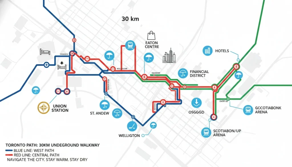
oronto’s PATH is one of the world’s largest underground pedestrian networks—yet most tourists don’t even know it’s there until they stumble upon an entrance. Spanning over 30 kilometers, this sprawling system connects the downtown core into a single, seamless, climate-controlled environment. It’s an absolute game-changer, especially during our harsh winters or on those rare rainy days when you’d rather not dodge puddles while trying to find your next landmark.
Think of the PATH as a “second city” running parallel to the streets above. It’s not just a set of tunnels; it is a bustling hub filled with food courts, retail shops, and services that keep the downtown business world moving. Once you learn to navigate the color-coded signs, you can traverse nearly the entire financial district without ever having to step outside or face the traffic.
What Is the Toronto PATH?
The PATH is a massive network that connects more than 75 buildings, offering a weather-proof way to navigate the heart of Toronto. It isn’t just for commuters, either; it’s open to anyone who wants to use it for quick, comfortable transit. Whether you are heading to a hockey game, a conference, or just looking for a shortcut to your hotel, the PATH is open year-round to keep you moving efficiently.
Because the system is owned and managed by multiple corporate property owners, it feels like a high-end indoor mall that never ends. It includes thousands of storefronts and restaurants, meaning you can grab breakfast, pick up souvenirs, and reach your meeting spot while staying perfectly dry and warm.
Extensive Reach: Over 30 kilometers of interconnected pedestrian walkways.
Massive Connectivity: Connects 75+ buildings, including office towers, hotels, and malls.
Weather-Proof: Designed specifically to protect you from the Canadian elements, 365 days a year.
World Record Status: Recognized as the largest underground shopping complex in the world.
Pro Tip: While the PATH is open 24/7 in some sections, most retail shops and food courts inside operate during standard business hours (roughly 7 a.m. to 9 p.m.). Don’t count on late-night shopping once the office crowd clears out!
What Buildings Are Connected on the PATH Map?
If you are staying or visiting the downtown area, chances are high that your destination is connected to the PATH. From the moment you step off your train at Union Station, you are already at the primary gateway to the network. From there, you can walk entirely underground to major stadiums, shopping centers, and iconic hotels.
Being able to walk from your hotel to a museum or a restaurant without getting lost in the street-level maze is a huge advantage for first-time visitors. The system is particularly dense around the Financial District, making it easy to hop between the city’s most impressive corporate and architectural landmarks.
Transit Hub: Union Station (the perfect starting point for any PATH journey).
Entertainment & Sports: Scotiabank Arena, Hockey Hall of Fame, and Roy Thomson Hall.
Shopping & Leisure: CF Toronto Eaton Centre.
Hotels: Fairmont Royal York, Sheraton Centre Toronto, and Delta Toronto Hotel.
Major Landmarks: Metro Toronto Convention Centre, City Hall, and all major Financial District towers.
Pro Tip: Look for the official “PATH” logo—a multi-colored icon—posted on doorways and elevators throughout the downtown core. If you see it, that building has a connection to the network.
How to Navigate the Toronto PATH Map
Navigating the PATH can feel like a labyrinth at first, but it is much easier once you understand the signage. The city uses a brilliant color-coded system to help you orient yourself: blue for North, red for South, yellow for East, and orange for West. If you see these colored arrows on the wall signs, they are telling you which direction you are traveling relative to the city’s grid.
Because the system can be confusing due to its sheer size, it is a great idea to keep a digital copy of the official map from toronto.ca saved on your phone. Even though the signs are excellent, having a bird’s-eye view of the tunnels helps you recognize which building you are currently in and which one you are heading toward.
Best Entry Point: Start your exploration at Union Station to get a feel for the main “arteries.”
Directional Clues: Follow the color-coded arrows on the walls (Blue=N, Red=S, Yellow=E, Orange=W).
Accessibility: Most paths are fully wheelchair-accessible with ramps and elevators clearly marked.
Amenities: You’ll find washrooms, food courts, and ATMs at almost every major tunnel intersection.
Pro Tip: Don’t be afraid to ask security guards or reception staff in the lobbies of the buildings you pass through. They are used to tourists asking, “Is the PATH entrance nearby?” and they are usually very happy to point you toward the right tunnel.
PATH Map Tips for First-Time Visitors
The most important rule for the PATH is to prepare before you descend. While you’ll often get decent cell signal in the tunnels due to a specialized antenna system, it’s not always 100% reliable in every deep corner. Download the map, save it, and use Union Station as your “anchor” so you always know where your main transit link is.
If you are in town for a short trip, use the PATH to maximize your comfort. If it’s raining, snowing, or just uncomfortably hot, it is by far the most pleasant way to move between the Eaton Centre and the waterfront. It keeps you connected to six different subway stations, making it the most efficient “backstage” route to explore Toronto.
Download First: Grab the PDF map from the city website before you enter the tunnels.
Anchoring: Always note which subway station you are closest to in case you need to exit the system quickly.
Transit Hub: The PATH connects to six major subway stations, linking you to the rest of the city effortlessly.
Weather Strategy: Use it as your primary route on bad weather days to keep your vacation stress-free.
Pro Tip: Treat the PATH like a shortcut, not a destination. If you ever feel “turned around” or the signs become confusing, just head up to the nearest lobby, exit to the street, and re-orient yourself with the city skyline. It’s always better to walk a block outside than to wander deep into a tunnel system you don’t recognize!
Toronto Transit Map for Tourists: TTC, Streetcar & GO Train
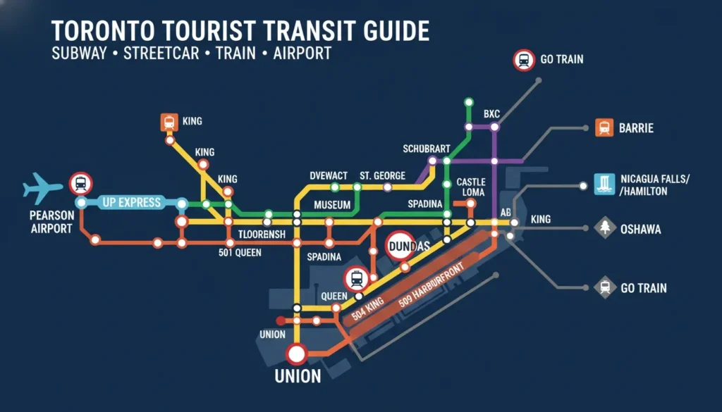
Combining your toronto city tour map with a reliable transit map is the single best way to move efficiently across the city. Toronto’s transit system, run by the Toronto Transit Commission (TTC), is expansive, but it can be overwhelming for a first-timer without a clear plan. By understanding how the subway lines, streetcars, and regional trains overlap on the map, you can easily switch between modes of transport and spend less time commuting and more time exploring the attractions on your list.
The key to mastering Toronto transit is realizing that each mode serves a specific purpose. The subway is for speed across long distances, streetcars are for scenic neighbourhood hops, and the GO Train is your gateway to regions outside the downtown core. Once you see these routes laid out over the city’s geography, you will feel like a local navigating the grid with ease.
TTC Subway Map — Key Tourist Stops
The TTC subway map is your backbone for downtown travel. Line 1 (Yonge-University) acts as a large “U” shape that covers most of the major tourist hotspots, while Line 2 (Bloor-Danforth) runs east-west across the top of the downtown core. For a tourist, these two lines are all you really need to memorize to reach the vast majority of must-see venues.
Key stations like Union, Osgoode, and St. Andrew act as anchor points for the major entertainment and financial districts. If you are heading to a museum, look for the Museum station; if you are shopping, Dundas or Queen stations will drop you right into the heart of the retail district. It is simple, fast, and far more reliable than sitting in a taxi during rush hour.
Line 1 (Yonge-University): The main loop connecting Union, Queen, Dundas, Museum, and Bloor-Yonge.
Line 2 (Bloor-Danforth): Crucial for reaching neighborhoods like the Annex (Spadina/St. George) and the Danforth.
Essential Stops: Memorize Union (for trains/waterfront), St. Andrew (for entertainment), and Museum (for culture).
Pro Tip: Avoid the subway during “rush hour” (8–9 a.m. and 5–6 p.m.) if you have a lot of luggage. It gets very crowded, and navigating the platforms with big bags is a headache for you and the daily commuters.
TTC Streetcar Routes Tourists Use Most
If the subway is the “fast track,” the streetcars are the “scenic route.” Toronto is one of the few North American cities that has kept its streetcar network alive and vibrant, and they are perfect for getting a real feel for the city. These routes run directly on the streets, meaning you get to see the architecture and local life while moving from one district to another.
The 501 Queen streetcar, in particular, is legendary for crossing almost the entire city, taking you from the trendy west-end neighborhoods to the beautiful beaches in the east. If you want to see how the city shifts from neighborhood to neighborhood, hop on a streetcar and grab a window seat.
Route 501 Queen: The longest route, perfect for a cross-city tour from The Beaches to Roncesvalles.
Route 504/505: Essential for accessing the Entertainment District and the bustling King Street scene.
Route 509/511: Your best bet for reaching the Harbourfront Centre and the CNE/Exhibition Place.
Route 506 Carlton: A great way to connect Cabbagetown and the famous Kensington Market.
Pro Tip: Use the “TTC Trip Planner” on the official website to see exactly which streetcar line takes you to your destination. It saves you from guessing which direction the streetcar is headed.
UP Express — Airport to Downtown Map
When you land at Toronto Pearson Airport, you want to get downtown as fast as possible. The UP Express is a dedicated train service that connects the airport directly to Union Station in just 25 minutes. It is vastly superior to taking a car, which can be held up by highway traffic, and it offers a comfortable, modern ride that lets you start your city map tour the moment you step off the train.
Trains run every 15 minutes throughout the day, so you rarely have to wait long. It is priced competitively at around $12.35, making it a budget-friendly way to avoid expensive airport ride-shares. It even makes a quick stop at Bloor station, which is handy if your hotel is in the west end of the city.
Travel Time: 25 minutes from Pearson to Union Station.
Frequency: Every 15 minutes, daily.
Cost: Approx. $12.35 per one-way adult ticket.
Intermediate Stops: Bloor (great for connections) and Weston.
Pro Tip: Buy your ticket online in advance or use your contactless credit card at the gate. It’s faster and prevents you from having to fumble with ticket kiosks after a long flight.
GO Train — Day Trips from Toronto Map
If you have an extra day and want to see more of Ontario, the GO Train is your ticket out of the city. These regional trains run from Union Station to various suburbs and nearby tourist destinations. They are comfortable, quiet, and offer a great way to see the surrounding landscape without needing to rent a car or deal with confusing highway maps.
Whether you are dreaming of seeing Niagara Falls or exploring the coastal towns like Hamilton, the GO Train map shows exactly how accessible these trips are. Just make sure to check the weekend schedule, as some lines have different frequencies compared to the standard weekday commuter service.
Niagara Falls: A popular seasonal service (check schedules for direct trains).
Regional Hubs: Easy access to Hamilton, Mississauga, and beyond.
Eastern/Northern Trips: Convenient routes to Pickering, Richmond Hill, and Vaughan.
Pro Tip: Download the “GO Transit” app. It provides real-time updates on departures and is essential for planning those longer day trips outside the city.
Accessibility on Toronto Transit Map
Accessibility is a major priority for the TTC. The official maps clearly mark which subway stations are “accessible,” meaning they have elevators and barrier-free paths from the street to the subway platform. If you or someone you are traveling with has mobility needs, you can easily plan your entire route by looking for the universal accessibility icon on the transit map.
In addition to the subways, the city is working hard to ensure streetcar stops are accessible as well. If you ever have trouble, there is also the “Wheel-Trans” service available for those who need extra assistance. Toronto is designed to be explored by everyone, and the mapping tools reflect that commitment to inclusivity.
Elevators: Always marked on the official subway map at every station that has them.
Barrier-Free: Check the map for the universal symbol at station entrances.
Assistance: Use the Wheel-Trans program if you have limited mobility and need a dedicated travel option.
Now that you know how to navigate our transit system like a pro, you’re ready to finalize your itinerary and hit the streets of Toronto!
Pro Tip: Before you board, check the TTC website for “Station Alerts.” Sometimes there are planned maintenance closures on weekends, and knowing this in advance will save you from having to take a shuttle bus!
Toronto Islands Map: How to Get There & What to Explore
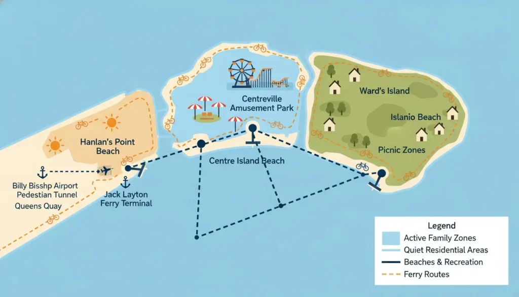
Toronto Islands city ke bilkul saamne hain — ferry se sirf 15 minute mein pahunch sakte ho — aur ye ek alag hi Toronto ka map hai explore karne ke liye. When you look at the city from the shoreline, the islands feel like a distant escape, but they are actually just a short ferry ride away from the downtown core. It’s essentially a different world, with car-free roads, sandy beaches, and some of the best views of the Toronto skyline you will ever see.
If you are planning a trip, keep in mind that the islands are a collection of several interconnected landmasses. You can easily spend an entire day here wandering between Centre Island, Ward’s Island, and Hanlan’s Point. Whether you want an active day of biking and swimming or a quiet afternoon of picnicking in the park, having a basic map of the island layout will help you figure out which ferry dock you need to aim for.
Toronto Islands Overview
The Toronto Islands are composed of three main areas: Centre Island, Ward’s Island, and Hanlan’s Point. You’ll catch the ferry from the Jack Layton Ferry Terminal at the foot of Bay Street on Queens Quay. The ferry runs year-round, though the schedule is significantly reduced during the winter months, so it is always a good idea to check the departure times before heading down to the dock.
Each island has its own distinct personality. Centre Island is the hub for families and park activities, Ward’s Island has a charming residential, cottage-like feel, and Hanlan’s Point is known for its wide beaches and the airport views. Because they are all connected by bridges and walkways, you can easily walk between them once you arrive.
Main Islands: Centre Island, Ward’s Island, and Hanlan’s Point.
Ferry Terminal: Jack Layton Ferry Terminal (9 Queens Quay W).
Accessibility: Ferry services run daily, year-round, though summer peak times are the busiest.
Pro Tip: During the busy summer months, buy your ferry tickets online in advance. It lets you use the express line at the terminal, saving you from waiting in the long ticket booth queues on hot weekend afternoons.
What’s on the Toronto Islands Map?
The map of the islands is packed with surprisingly diverse activities. If you are traveling with kids, Centreville Amusement Park is a must, featuring over 30 rides and an old-school carousel. For beach lovers, there are several distinct spots to choose from, ranging from the popular Centre Island Beach to the more secluded, clothing-optional section at Hanlan’s Point.
Beyond the thrills and swimming, the islands are a nature lover’s dream. You can explore the Franklin Children’s Garden, rent kayaks to paddle through the serene lagoons, or even play a round of disc golf. Don’t forget to look up occasionally—the islands are right in the flight path for Billy Bishop Airport, so you’ll get a close-up view of planes coming in to land.
Centreville Amusement Park: More than 30 kid-friendly rides and attractions.
Beaches: Centre Island Beach, Ward’s Island Beach, Hanlan’s Point (clothing-optional), and Gibraltar Point Beach.
Nature & Gardens: Franklin Children’s Garden and various peaceful lagoon trails.
Recreation: Boat and kayak rentals, fishing spots, and a public golf course.
Airport: Billy Bishop Toronto City Airport is located on the islands, accessible via a pedestrian tunnel.
Pro Tip: Pack a picnic! While there are food stands near the Centre Island dock, having your own cooler with snacks and drinks gives you the freedom to set up shop at a quiet spot on Ward’s Island away from the main crowds.
Toronto Islands Ferry Map & Schedule
Navigating the ferry system is straightforward once you know which dock you need. You have three main destinations from the Jack Layton Ferry Terminal: Centre Island, Hanlan’s Point, and Ward’s Island. If you’re not sure which one to pick, Centre Island is the best “all-rounder” for a first visit, while Ward’s Island is the best choice if you want a quieter, more scenic walk through the local residential area.
The islands are very walkable, but they are also quite large. A walk from one end of the island chain to the other can take 20 to 40 minutes, depending on your route. If you want to see everything without getting tired legs, I highly recommend renting a bike near the Centre Island ferry dock. It’s the standard way to get around and lets you cover much more ground in an afternoon.
Terminals: Ferries to Centre Island, Hanlan’s Point, and Ward’s Island all depart from Jack Layton Ferry Terminal.
Departure Location: Queens Quay West and Bay Street (behind the Westin Harbour Castle).
Island Mobility: Walking between islands takes about 20–40 minutes; bike rentals are available on Centre Island and are highly recommended.
Schedule: Check the official city website for the 2026 summer or winter ferry timetables.
Pro Tip: If you want the most iconic photo of the Toronto skyline, take the ferry to Ward’s Island. The walk back toward the main park area offers the best panoramic views of the city across the water, especially during sunset.
Printable Toronto City Tour Map: Free Resources
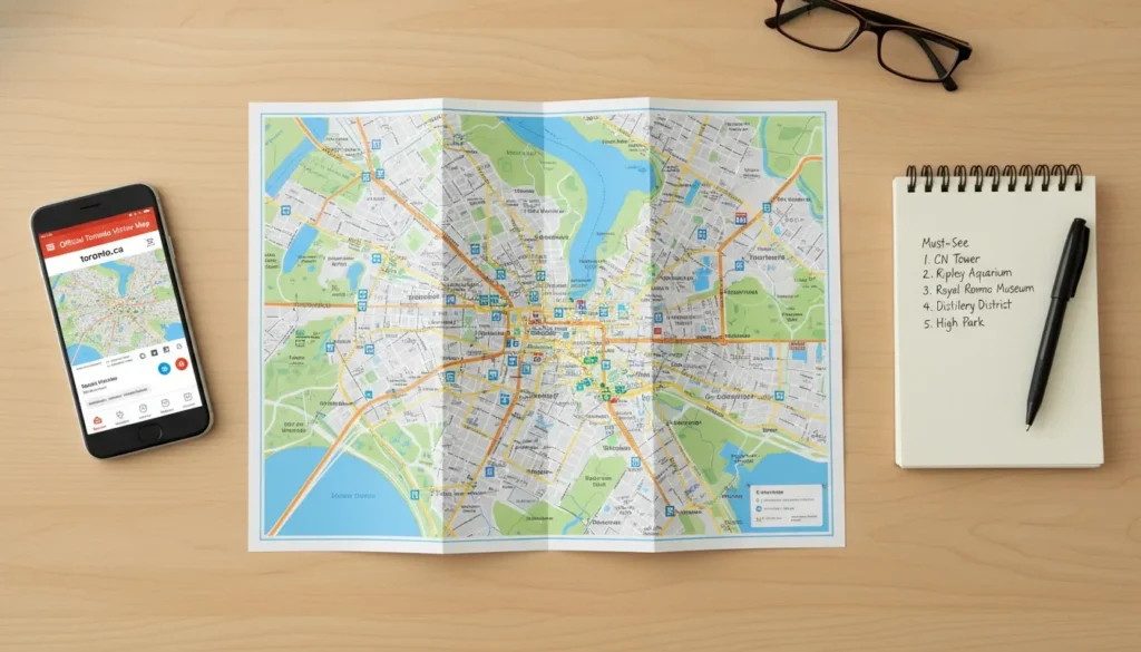
If you are the type of traveler who prefers holding a real map over staring at a phone screen, you are not alone. There is something undeniably satisfying about unfolding a physical paper map and tracing your route with your finger. This section is dedicated to those who want a reliable, offline-ready printable toronto city tour map, making it perfect for elderly visitors, families, or anyone who just wants to avoid the stress of battery drainage and small fonts.
Having a printed copy in your bag provides a level of peace of mind that digital devices simply cannot match. You don’t have to worry about roaming data, dead zones, or screen glare. Whether you are prepping your travel folder at home or need a quick handout once you arrive, these resources ensure you are never without a solid plan for your day.
Free Printable Toronto Maps Online
The internet is full of complex maps, but for a tourist, simplicity is key. The official City of Toronto visitor map remains the gold standard because it is clear, concise, and updated to reflect current street layouts. If you are looking for something more thematic, like a specialized walking map or an illustrated bus tour guide, several reputable sources provide high-quality PDFs that are formatted perfectly for standard letter-sized printing.
I recommend downloading a few of these to your computer before you leave. You can print the downtown detail for navigation and keep a broader city map for long-distance planning. These files are designed for public use, so you don’t have to worry about copyright issues when printing them for your personal travel files.
City of Toronto Official Visitor Map PDF: The most reliable overview for major sites; available at toronto.ca.
City Sightseeing Illustrated Map: Great for seeing the “big picture” of major attractions; find it at citysightseeingtoronto.com.
Toronto PATH Downtown Map: Essential for navigating the Financial District; download it from toronto.ca.
Strathcona Walking Map: Offers a unique, neighborhood-level view available via rendezvouscanada.ca.
Authentik Canada Guide: A fantastic supplementary resource for tourist-focused highlights at authentikcanada.com.
Pro Tip: When printing, select “Fit to Page” in your printer settings. This ensures the map scales perfectly to your paper size without cutting off the important legends or key street names at the edges.
Where to Pick Up Free Paper Maps in Toronto
Sometimes you just want to walk into a building and grab a map from a rack. Toronto’s tourism infrastructure is set up to make this incredibly easy. The best place to start is the Union Station Tourist Information Centre, which acts as the city’s unofficial map headquarters. The staff there can give you exactly what you need based on how you plan to travel, whether it’s by subway, bus, or on foot.
If you are flying in, you can often find maps right at the arrivals area of Billy Bishop Airport. Otherwise, simply check your hotel lobby; most downtown accommodations have a rack of local brochures and maps right next to the concierge desk. Even the big shopping hubs like the Eaton Centre have visitor service kiosks that keep a healthy supply of these printed guides on hand.
Union Station Tourist Information Centre: The absolute best starting point for a high-quality, free paper map.
Billy Bishop Airport: Look for map stands in the arrival terminal.
Downtown Hotels: Check the lobby or ask the concierge if they have the “Official Visitor Map.”
CN Tower & Eaton Centre: Both locations have visitor service desks that stock tourism materials.
Pro Tip: Pick up two copies—one for your bag and one to leave in your hotel room. If you happen to lose the first one while exploring, you won’t have to go all the way back to the station to grab a replacement.
How to Print a Custom Toronto Map at Home
Creating your own “custom” map is a pro move that can make your trip much more efficient. If you know you are only visiting four specific neighborhoods, you can use Google Maps on your desktop to create a saved list or a “My Map,” and then take a screenshot. This allows you to print only the information that matters to you, cutting out all the clutter of a standard, massive city map.
If you are using PDFs from the city website, just open them in your browser and use the print function. For specific routes, such as a hike or a heritage walk, use the “print” feature on the AllTrails website. This generates a clean, readable version of the trail path that is easy to follow while you are on the move.
Google Maps Custom View: Save your favorite spots to a list, screenshot, and print for a personalized neighborhood map.
Direct PDF Print: Use the print command in your PDF viewer for official City of Toronto maps.
Maps.me App: Use this for an offline view that you can capture and print for your personal travel binder.
AllTrails Routes: Use the built-in print functionality on the website to get a clear map of any specific walking trail.
Pro Tip: If you are printing your own map, highlight your hotel location in one color and your top three attractions in another. It’s a small step that makes navigating a foreign city feel instantly more familiar the moment you step outside.
Toronto City Tour Map by Theme: Plan Your Perfect Day
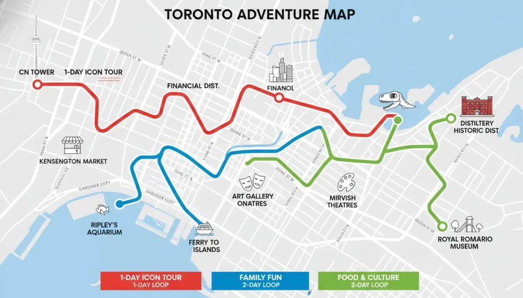
Having a map is not enough—you also need a good plan. Toronto is a big city, and it is easy to get lost or waste time traveling back and forth. To help you explore, I have created these simple, theme-based routes. You can use these with your map to make sure you see the best parts of the city without any stress.
By grouping your stops together based on what you like to do, you will save time and energy. Each of these routes is designed to keep you moving in one direction, so you can enjoy your day rather than worrying about which bus or train to take next.
1-Day Toronto Tour Map Route
If you only have one day, focus on the “South-to-East” area. This route hits the most famous landmarks while keeping your walking and travel time short. Starting at Union Station puts you in the middle of everything, making it very easy to move between the waterfront and the historic areas.
Morning: Start at Union Station, then walk to the CN Tower, Ripley’s Aquarium, and Rogers Centre.
Afternoon: Take a short streetcar ride east to the Distillery District, then visit St. Lawrence Market and see the famous Flatiron Building.
Evening: Finish with a relaxing walk along the Harbourfront and catch the ferry to the Toronto Islands to see a beautiful sunset over the city.
Pro Tip: Do not try to do too much in one day. Pick the top two places you really want to see and enjoy them properly instead of rushing!
2-Day Toronto Tour Map Route
Two days gives you more time to explore. We will split your trip into two parts: “Modern Downtown” and “Cultural Neighborhoods.” This helps you see the tall office buildings and the fun, local streets of Toronto in a balanced way.
Day 1: Explore the Downtown core, the Financial District, and the Waterfront. Spend your afternoon using the PATH underground to see the shopping areas hidden beneath the buildings.
Day 2: Go north to visit the Royal Ontario Museum (ROM) and shop in Bloor-Yorkville. In the afternoon, walk through the fun streets of Kensington Market and visit the beautiful castle, Casa Loma.
Pro Tip: Buy a “CityPASS” if you want to visit the main ticketed places like the ROM and CN Tower. It is cheaper than buying single tickets at each location.
Family-Friendly Toronto Tour Map
Toronto is a great place for families because many of our top attractions are fun for all ages. The best way to travel with kids is to mix indoor activities with outdoor play so they don’t get bored.
Top Stops: Ripley’s Aquarium, Centreville Amusement Park (on the islands), and the High Park Zoo.
For Thrills: Visit the CN Tower to walk on the famous glass floor.
Outdoor Fun: Play at the Franklin Children’s Garden on the islands or hike the trails in High Park.
Pro Tip: If the kids are tired of walking, take them straight to High Park. It is free, huge, and has a great playground and a small train that kids absolutely love.
Food Lover’s Toronto Neighbourhood Map
If you want to taste the best food in Toronto, visit the neighborhoods that are famous for their local flavors. Skip the fancy sit-down dinners and focus on the markets, street food, and small shops that make our city special.
Kensington Market: Perfect for trying many different types of multicultural street food.
Chinatown: Go to the area around Queen and Spadina for the best dumplings and baked goods.
Little Italy: Visit College Street for great pasta and relaxed outdoor patios.
St. Lawrence Market: A must-visit on the weekend for fresh food and the famous peameal bacon sandwich.
Distillery District: Great for finding high-quality chocolates and cozy coffee shops.
Pro Tip: Bring some cash with you! While most shops take cards, some small family-owned stalls in the markets only accept cash.
Art & Culture Toronto Map Route
Toronto’s art scene is spread out across the city, so use your map to link these spots together. You can see world-class museums and local street art in the same day if you plan it right.
Museums & Galleries: Visit the Art Gallery of Ontario (AGO) and the Museum of Contemporary Art (MOCA).
Film: Check out the TIFF Lightbox in the Entertainment District.
Street Art: Walk through Graffiti Alley to see some of the coolest street art in the country.
Historic Art: Explore the many small galleries inside the Distillery Historic District.
Global Art: If you have time, visit the Aga Khan Museum in East Toronto for beautiful art and architecture.
Pro Tip: Check the AGO website before your visit. They often have “free admission” on Wednesday evenings, which is a great way to save money while seeing incredible art.
Frequently Asked Questions About Toronto City Tour Map
Even with a great guide, it is normal to have a few questions before you hit the streets. Below are the most common questions from first-time visitors about navigating Toronto. If you can’t find what you are looking for here, remember that the staff at the Union Station information booth are your best local resource.
Is there a free Toronto city map for tourists?
Yes, there are several. The most reliable version is the official 2026 Visitor Map provided by the City of Toronto. You can download the PDF for free at toronto.ca. If you prefer a physical copy to carry in your bag, you can pick up a high-quality free paper map at the Union Station information centre as soon as you arrive.
Is there an underground city in Toronto?
Yes, it is called the PATH. It is a massive, 30+ kilometer network of underground walkways that connects over 75 buildings in the downtown core. It is incredibly useful for tourists, especially during the cold winter months or on rainy days, because it allows you to get from your hotel to major attractions without ever stepping outside into the weather.
Where can I find the TTC subway map?
You can find the official TTC subway map directly on the TTC website at ttc.ca. If you prefer a printed version, the subway lines are clearly marked on the City of Toronto’s official visitor map, which you can pick up for free at any major subway station or visitor kiosk downtown.
Where can I get a free paper map of Toronto as a tourist?
The best place to get a free paper map is the Tourist Information Centre located right inside Union Station. If you are not arriving by train, you can also find them at the front desk of almost any major downtown hotel. If you want to be prepared before you land, you can even request one by emailing visitoreconomy@toronto.ca.
What is the best app to navigate Toronto as a tourist?
For daily navigation, Google Maps is the most reliable tool for walking and transit directions. If you plan on doing nature walks or hiking in the city parks, I highly recommend downloading AllTrails. If you are taking the hop-on hop-off bus tour, the City Sightseeing app is perfect because it gives you live tracking of where the buses are in real-time.
How do I plan a self-guided walking tour of Toronto?
The City of Toronto has made this very easy by creating over 49 free self-guided routes. You can find these on the city’s official website, toronto.ca, organized by theme—including culture, architecture, history, and nature. Each route comes with a free PDF map that you can print or download to your phone to guide your walk.
How long does it take to walk from CN Tower to Distillery District?
It takes about 20 to 25 minutes to walk there on foot if you take a direct route. However, if you want to save your energy for exploring the shops and cafes once you arrive, you can take the TTC Route 504 streetcar. It is a very simple, scenic ride that gets you there in about 10 minutes.
Pro Tip: Always carry your map or phone in a safe pocket! Toronto is a very safe city, but like any big metropolis, it’s always best to keep your valuables tucked away while you’re busy navigating the busy downtown streets.
Useful Map Resources & Reference Links
Ye trusted resources aapko Toronto tour planning mein aur help karenge. Keep these links saved for your trip so you can quickly access the most accurate, up-to-date information while you are exploring the city.
Official Toronto Map & Tourism Resources
Official City of Toronto Visitor Map: toronto.ca/explore-enjoy/visitor-toronto/
Hop-On Hop-Off Map: citysightseeingtoronto.com/maps-old/map-hop-on-hop-off-toronto/
TTC Transit Map: ttc.ca/routes-and-schedules
Self-Guided Walking Tours: toronto.ca/explore-enjoy/history-art-culture/
Toronto Islands Info: toronto.ca/explore-enjoy/parks-recreation/park-listing/2099/
Destination Toronto: destinationtoronto.com
Authentik Canada Guide: authentikcanada.com
AllTrails Toronto: alltrails.com/canada/ontario/toronto
Pro Tip for Your Trip
Pro Tip: Download all your chosen maps while you are still at your hotel on Wi-Fi. This ensures you have full access to your route even if your data signal drops while you are deep in the concrete canyons of the downtown core or out on the islands!